In recent decades, agriculture has undergone a profound transformation, shifting from traditional methods toward technologically advanced practices. One of the most revolutionary developments in this evolution is the use of remote sensing—particularly satellite technology—to enable precision farming. This cutting-edge approach harnesses the power of satellites orbiting high above the Earth to provide farmers with detailed, timely, and actionable information about their fields. This technology not only increases productivity but also promotes sustainable farming practices by optimizing the use of resources such as water, fertilizers, and pesticides.
𝐓𝐡𝐞 𝐑𝐢𝐬𝐞 𝐨𝐟 𝐑𝐞𝐦𝐨𝐭𝐞 𝐒𝐞𝐧𝐬𝐢𝐧𝐠 𝐢𝐧 𝐀𝐠𝐫𝐢𝐜𝐮𝐥𝐭𝐮𝐫𝐞
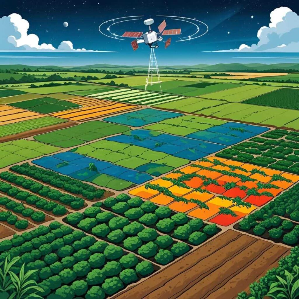
Remote sensing refers to the process of acquiring information about an object or area from a distance, typically using sensors mounted on satellites, aircraft, or drones. In agriculture, satellites equipped with various sensors capture images and data that reflect the condition of crops, soil, and surrounding environments over large expanses of farmland.
The availability of high-resolution satellite imagery combined with advancements in data processing and Geographic Information Systems (GIS) has made it possible for farmers to monitor their fields with unprecedented detail and frequency. Instead of relying solely on manual scouting or historical knowledge, farmers can now access near real-time data to make informed decisions, significantly improving the precision and efficiency of their operations.
𝐇𝐨𝐰 𝐒𝐚𝐭𝐞𝐥𝐥𝐢𝐭𝐞𝐬 𝐒𝐮𝐩𝐩𝐨𝐫𝐭 𝐏𝐫𝐞𝐜𝐢𝐬𝐢𝐨𝐧 𝐅𝐚𝐫𝐦𝐢𝐧𝐠
Precision farming, also known as precision agriculture, aims to optimize crop production by managing variability within fields rather than treating a whole field uniformly. Satellites support this approach in several key ways:
𝟏. 𝐌𝐨𝐧𝐢𝐭𝐨𝐫𝐢𝐧𝐠 𝐂𝐫𝐨𝐩 𝐇𝐞𝐚𝐥𝐭𝐡 𝐚𝐧𝐝 𝐒𝐭𝐫𝐞𝐬𝐬:
Satellites capture multispectral and hyperspectral images that reveal information invisible to the naked eye. For example, the Normalized Difference Vegetation Index (NDVI) is a commonly used indicator derived from satellite data that measures vegetation vigor and health. By analyzing NDVI maps, farmers can detect areas of their fields that may be suffering from drought, nutrient deficiency, pest attacks, or disease outbreaks early—before visible symptoms appear. This early detection enables targeted interventions, reducing crop losses and unnecessary treatments.
𝟐. 𝐒𝐨𝐢𝐥 𝐚𝐧𝐝 𝐌𝐨𝐢𝐬𝐭𝐮𝐫𝐞 𝐀𝐬𝐬𝐞𝐬𝐬𝐦𝐞𝐧𝐭:
Understanding soil conditions is vital for effective crop management. Satellites equipped with sensors like Synthetic Aperture Radar (SAR) can penetrate cloud cover and provide soil moisture estimates. This information helps farmers optimize irrigation schedules, avoiding both water stress and overwatering. Additionally, satellites can help identify soil types and texture variations across a farm, guiding decisions on fertilizer application and crop selection.
𝟑. 𝐌𝐚𝐩𝐩𝐢𝐧𝐠 𝐚𝐧𝐝 𝐌𝐚𝐧𝐚𝐠𝐢𝐧𝐠 𝐅𝐢𝐞𝐥𝐝 𝐕𝐚𝐫𝐢𝐚𝐛𝐢𝐥𝐢𝐭𝐲:
No two parts of a field are exactly alike. Variations in soil fertility, texture, drainage, and topography affect how crops grow. Satellite data enable the creation of detailed maps showing these spatial variations. Farmers use this data to apply inputs—seeds, fertilizers, pesticides—variably across their fields, matching the specific needs of each zone. This not only increases yield but also minimizes input waste and environmental impact.
𝟒. 𝐂𝐫𝐨𝐩 𝐘𝐢𝐞𝐥𝐝 𝐄𝐬𝐭𝐢𝐦𝐚𝐭𝐢𝐨𝐧 𝐚𝐧𝐝 𝐅𝐨𝐫𝐞𝐜𝐚𝐬𝐭𝐢𝐧𝐠:
By monitoring crop development throughout the growing season, satellites provide valuable data for estimating yields before harvest. Combining satellite imagery with weather and soil data, predictive models can forecast crop performance, helping farmers plan logistics, market sales, and supply chain management more effectively.
𝟓. 𝐃𝐚𝐦𝐚𝐠𝐞 𝐚𝐧𝐝 𝐃𝐢𝐬𝐚𝐬𝐭𝐞𝐫 𝐀𝐬𝐬𝐞𝐬𝐬𝐦𝐞𝐧𝐭:
Satellite imagery plays a crucial role in assessing crop damage caused by extreme weather events such as floods, droughts, hailstorms, or pest invasions. This rapid damage assessment aids farmers and policymakers in decision-making for disaster relief, insurance claims, and recovery planning.
𝐏𝐫𝐚𝐜𝐭𝐢𝐜𝐚𝐥 𝐈𝐦𝐩𝐥𝐞𝐦𝐞𝐧𝐭𝐚𝐭𝐢𝐨𝐧 𝐚𝐧𝐝 𝐀𝐜𝐜𝐞𝐬𝐬𝐢𝐛𝐢𝐥𝐢𝐭𝐲
The integration of satellite data into everyday farming practices is made possible through user-friendly platforms and services. Companies and governmental organizations now offer agriculture-focused remote sensing products that farmers can access via smartphones, tablets, or computers. These platforms often provide dashboards, alerts, and recommendations tailored to specific crops, regions, and farming practices.
Moreover, the growing availability of free satellite data, such as from NASA’s Landsat program or the European Space Agency’s Sentinel satellites, democratizes access to high-quality remote sensing information. Farmers, researchers, and agricultural extension workers worldwide can leverage these datasets to improve farm management, even in remote or resource-limited areas.
𝐂𝐡𝐚𝐥𝐥𝐞𝐧𝐠𝐞𝐬 𝐚𝐧𝐝 𝐅𝐮𝐭𝐮𝐫𝐞 𝐏𝐫𝐨𝐬𝐩𝐞𝐜𝐭𝐬
Despite the tremendous benefits, challenges remain in fully realizing the potential of satellite remote sensing for agriculture. One key issue is the spatial and temporal resolution of satellite images—while many satellites provide frequent global coverage, their image resolution may be too coarse for small or highly heterogeneous fields. Cloud cover can also limit optical satellite imagery in certain regions or seasons.
Data processing and interpretation require technical expertise, and there is a continuous need for training farmers and extension agents to use these tools effectively. Additionally, integrating satellite data with other sources such as drones, soil sensors, and weather stations creates a more comprehensive picture but demands advanced data management capabilities.
Looking forward, innovations such as higher-resolution small satellites (CubeSats), artificial intelligence for image analysis, and improved sensor technology promise to overcome many of these limitations. The future of satellite remote sensing in agriculture is bright, with the potential to further increase yields, conserve resources, and promote climate-smart farming practices.
𝐂𝐨𝐧𝐜𝐥𝐮𝐬𝐢𝐨𝐧
Satellite remote sensing has become a cornerstone of modern precision agriculture, transforming the way farmers understand and manage their fields. By providing detailed insights into crop health, soil moisture, and field variability, satellites empower farmers to make smarter decisions, reduce environmental impacts, and increase productivity. As technology continues to advance and accessibility improves, the adoption of remote sensing will expand, supporting a more sustainable and resilient agricultural future for feeding the world’s growing population.